Welcome to Kagadi District Local Government
Kagadi District is one of the 134 Districts of Uganda located in the Mid-Western part of the country. The District is bordered by Lake Albert to the West, Kikube District to the North, Kibaale District to the East, Kyegegwa, Kyenjojo, Kabarole and Ntoroko Districts in the south. It is approximately 252Kms from Kampala, the Capital City of Uganda. The district location puts it in a region that is currently served with key development infrastructure like tarmac roads and oil exploration.
DISTRICT VISION
A Transformed and Economically Productive District Population by 2040.
MISSION
To Provide Quality and Improved, Governance for Prosperity of all People in the District.
GOAL
“Increased Household Incomes and Improved Quality of Life of Kagadi People”
Size
The District is one of the largest districts in the country. It covers a total area of approximately 241,551 square kilometers, while 150 sq km of which land area covers 200,523 square kilometers. On the other hand, 41,028 sq kms is covered by water bodies.
Key Geographical information
Kagadi District has a favorable climate. It enjoys a bi-modal rainfall type which varies between 1000 mm-1500 mm per annum i.e. moderate to high rainfall. Rainfall comes in two peaks, one from March to May and the second from September to December. However, the Western part of the District bordering the Rift valley is generally dry. Temperatures are relatively high varying between 150c and 300c with the hottest temperatures recorded in the Rift Valley Zone.
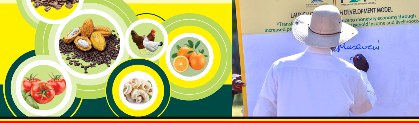
The bi-modal type of rainfall is conducive for rain fed agricultural production throughout the year and crops mainly grown include bananas, tobacco, coffee, maize, beans and tea. Up-land rice and cocoa are increasingly gaining importance in the District.
Vegetation
There are three broad categories of vegetation in the District namely: the modified equatorial type, the wooded savannah mosaic and savannah grassland.
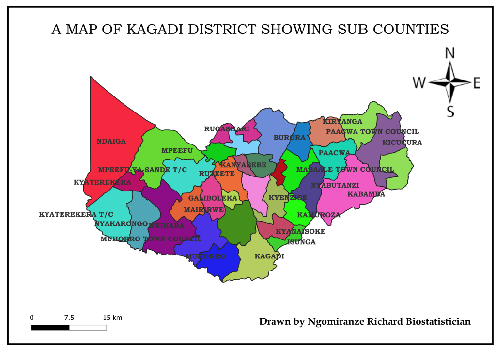
The modified equatorial vegetation covers a greater of the District especially in the Sub counties of, Kiryanga, Pachwa, and Kabamba. This type of vegetation used to be equatorial in nature but has been modified as a result of human activity.
The wooded savannah mosaic covers a greater part of the district and forms a transitional zone from the modified equatorial vegetation to the open savannah grassland. It is common in the Sub Counties of Kyanaisoke, Kyenzige, Mabaale, Kagadi, Ruteete, Muhorro, parts of Bwikara.
The savannah grassland is typical in areas where human activity has modified the wooded savannah mosaic. It is mainly found in the Sub Counties of Rugashari, Burora, Kyakabadiima Mpeefu, Kyaterekera, and Ndaiga
The thick forests especially those on private land are being used for timber harvesting although this poses a threat of environmental degradation since reforestation and afforestation are very limited. There is relative high price of timber and its products in the district are low compared to other districts and the District is a major source of timber to the Kampala market.
The open grassland and thicket vegetation promote livestock farming. However most of such areas have not yet been properly developed.
Topography
Kagadi District is part of a central plateau with an altitudinal range of about 2000- 4000 ft. above sea level. The lowest area of the District is occupied by the L. Albert rift at 2040 ft. above sea level.
The hilly and rocky relief presents challenges during construction and maintenance of roads and buildings and makes agricultural production difficult like through inducing soil erosion. The Rift valley terrain in Ndaiga Sub County and its associated features make service delivery to the lake shore communities very difficult and hence the increasing need to bring services nearer to such communities through opening up an all weather road to the lake. The location of the district within the Albertine region provides a high potential for oil and gas resources which are yet to be explored.
Soils
The process of erosion and accumulation that acted upon the land surfaces gave rise to several types of soils in Kagadi District. With exception of the lowlands which are covered by lake deposits, the soils of the district are of ferrallitic type. Productivity of these soils largely depends on favourable rainfall, adequate depth and maintenance of the humic top soil. However, some clay deep loam soils of Buyaga east are sufficiently fertile to support a diversity of crops.
There are basically 3 soil mapping units in Kagadi District namely Buyaga Catena shallow loams, Red clay loams and Brown gravelly clay loams. Shallow Loams have moderate acidity with moderate Productivity and mainly support the growing of Tobacco and Cotton. In the areas of Mabaale,Pachwa and Kiryanga sub counties.
Rich soil endowment provides an opportunity for the growing of a variety of crops as already highlighted above. However there is evidence of loss of soil fertility through leaching especially where agricultural production is done in formerly forested areas. Buyaga East and Buyaga West Counties generally lack clay soils and this makes construction of brick houses expensive since such materials have to be ferried from the neighboring Counties.
Wetlands
Wetlands cover 12.6% of the total district area. There are 3 wetland systems in the district namely theprimary, secondary and tertiary wet land systems. Examples of primary wet land systems include Muzizi,and Nkusi riverine wet lands all of which drain into Lake Albert. Secondary wetland systems drain into the primary wet land systems examples of which include Mpamba and Mutunguru River in wetlands. The tertiary wet land systems from the original catchment for all the other wet land systems.
Wetlands form boundaries for most administrative units and are a good source of raw materials for the hand craft industry which mainly employs women. Rudimental fishing is also done in these wet lands by the adjacent communities especially mud fish which is a delicacy and nutrition boost. Wet lands are a good source of clay and sand which have been used during the Construction of public and private facilities.
This is also evidenced by the various brick making and sand excavation points in these wet lands which mainly employ the male youths.
Permanent wet lands ease development of safe water sources especially deep and shallowwells since they act as water reservoirs. However, road construction through thesewetlands is rather difficult and expensive and this justifies the high demand for more culverts in most of the Sub Counties.